
RhinoLands / Lands Design
Follow RhinoLands / Lands Design:
Visit RhinoLands / Lands Design:
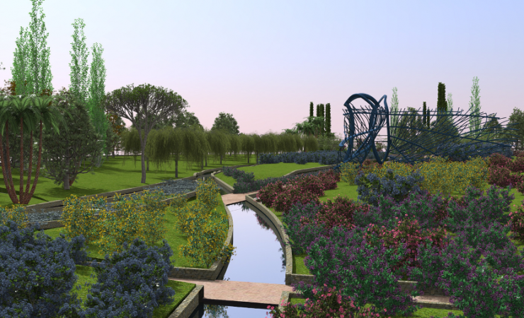
ADVANCED SOLUTION FOR LANDSCAPE DESIGN
BIM TECHNOLOGY FOR 2D TECHNICAL DRAWINGS, 3D MODELING AND PHOTOREALISTIC RENDERING.
Why use RhinoLands / Lands Design?
Powerful Terrain Modeling Tools
Create terrains from contours, elevation curves and point clouds. Terrains can be also scanned and imported from the cloud by picking a location from a satellite map. Lands includes tools to modify terrains, add cuts and fills, paths, holes or calculate the volume of land movements. All this data is stored in the terrain and can be modified at any time.
BIM/LIM (Landscape Information Modeling) in your Project
Lands provides smart objects, such as vegetation elements, civil work objects and terrains that can be easily edited and documented in quantity take-offs. Lands provides tools to produce 2D technical drawings that are always linked to the 3D model and to the related lists and documentations.
Extensive Plant Database in 3D / 2D
Lands provides a plant database with more than 1800 species. You can select the ideal plant for your site by filtering the list according to specific criteria: climate, type of soil, wind resistance, flowering and fructification, etc.
Each plant species has its own customizable display modes in 2D and 3D and they are ready for rendering, exporting plans, and season and growth simulation.
Generate Dynamic 2D Documentation
Turn your 2D sketch into a 3D project ready for visualization. Generate 2D technical plans from the 3D model and add dimensions, labels, tags, plant photos and other annotations to get the project ready for documentation. Produce different layouts such as setting out plan, irrigation, and dimension plan by using the layer manager to organize your project. Use the listing tools to generate quantity take-offs for plants, urban furniture elements, zones or volume of cuts and fills from terrain operations.
Parametric Design
Automate design workflows with vegetation, terrains and civil work elements. Save time by avoiding repetitive tasks, create custom functionalities and test different design options faster.
All this is achieved with Grasshopper, a visual programming environment available in the Lands Design version for Rhino.
Bring your Project to Life with Animated Videos and Realistic Images
Present your project with realistic images, virtual tours and animated videos. Walk through the project, play vegetation season change simulation, enable sunlight motion, wind effect and plant growth. In addition, you may apply your desired render engine like Enscape, Lumion, V-Ray, etc.
Latest news on RhinoLands / Lands Design

Rhino User Meeting in Porto (Portugal) – Early Bird Tickets Now Available
Rhino User Meeting Porto📅 Date: May 30, 2025🕓 Time: 9:00-18.30📍 Venue: Faculty of Architecture of the University of Porto (FAUP)McNeel Europe, in collaboration with FAUP, is organizing the first Rhino User Meeting in Portugal on May 30. The event is an opportunity to...
Building 3D web apps with Rhino Compute and Modelup – Recorded Webinar Now Available!
If you could not attend the latest Rhino User Webinar live, the recording is now available!Do not miss it if you are interested in building 3D web apps and configurators with Rhino Compute and Grasshopper. Emil Poulsen has shared his best tips
Developing a Rhino Plugin with Python – Recorded Webinar Now Available!
If you missed the latest Rhino User Webinar, it is now available!Get guided by Michael Redder-Howard in the process of building and managing a Rhino plug-in with Python. Based on the experience he built at 3XN, you will learn about his
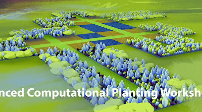
Advanced Computational Planting Workshop
Advanced Computational Planting WorkshopA workshop on Land Kit's Plant Kit May 9, 9 AM-12:30 PM ESTThe workshop series will provide you with the techniques for detailed planting design using Land Kit. Learn how to implement a rules-based planting approach using...
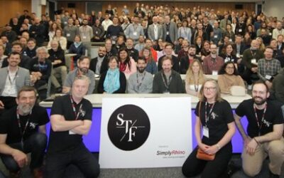
VisualARQ at Shape to Fabrication 2025
Shape To Fabrication 2025 London, UK April 12–17, 2025 The 9th edition of Shape to Fabrication (STF) is just around the corner, bringing together pioneers from the fields of Architecture, Engineering, Construction (AEC), and Design. Known for showcasing innovative,...
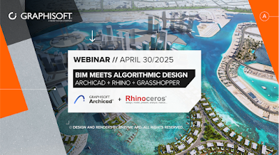
Webinar “BIM Meets Algorithmic Design” – April 30, 2025 at 6PM CEST
Webinar "BIM Meets Algorithmic Design"April 30, 2025 at 6PM CESTJoin us for our upcoming webinar, where Graphisoft, McNeel, and Enzyme APD experts will demonstrate the uniquely powerful combination of BIM workflows, algorithmic design, and freeform modeling. Get to...
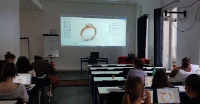
Using Rhino for the First Time to design an Engagement Ring
Claudia Romano, a Rhino Authorized Trainer with a vast experience in jewelry design, was invited to teach a two-day workshop at the Institut National de Gemmologie in Paris (France), thanks to the Erasmus+ exchange programme. Using Rhino, students had to design
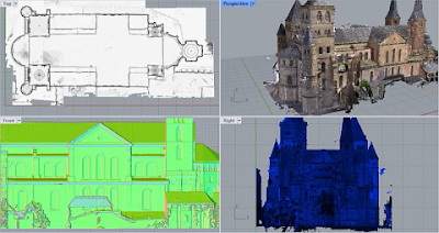
Qbitec for Rhino – new “large-scale point cloud data” plug-in
Qbitec for Rhino - new "large-scale point cloud data" plug-inQbitec are in the early stages of development and would love to hear from this expert community. Your experience and insights are invaluable to them, and they would like to know:What
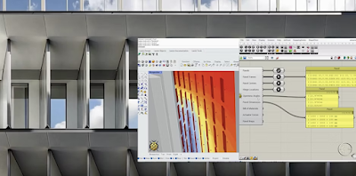
Elytra: Parametric Façade Design Online Workshop by Sustainable Design Network (April 25, 5-7 PM CEST)
Elytra: Parametric Façade Design Online Workshop by Sustainable Design NetworkApril 25, 5-7 PM CEST Participants will learn to set up Elytra, define panel parameters, integrate solar radiation with Ladybug Tools, and run energy and comfort.The session begins with an...